A Cautionary Tale of DIY Meteorology: Consult a Professional when Lives and Property Are at Risk
Published: September 11th, 2023
The value of having timely weather data and a professional to interpret these weather data and provide forecasts for any particular operation can be life-saving. Whether it be fog on highways reducing visibility and causing multiple vehicle accidents or ships at sea threatened by tropical cyclones, professional expertise can save lives, equipment and property damage. These losses can also extend to unnecessary disruption in workforce hours of normal operations. In my experience investigating accidents, the root cause of most accidents is misinterpretation by an operator making incorrect assessments of collected weather data. The professional, on the other hand, looks at these same data differently and generally makes recommendations based on scientific knowledge, expertise, and principles. For example, the average operator without professional assistance typically looks at weather products from applications that simply pull in direct model output, without expert interpretation or quality-control of that data. At the worst, only climatology products are reviewed. This mistake is further exacberated when operational decisions are made.
A more experienced (not a professional) user may misinterpret weather forecasts or may not realize the significance of obtaining up-to-date forecast aids from a variety of sources. The common mistake is ultimately basing operational decisions on these raw data, without understanding their limitations or the best-practices governing their use. Regardless, nothing can take the place of a certified, professional meteorologist providing input to the decision-making process.
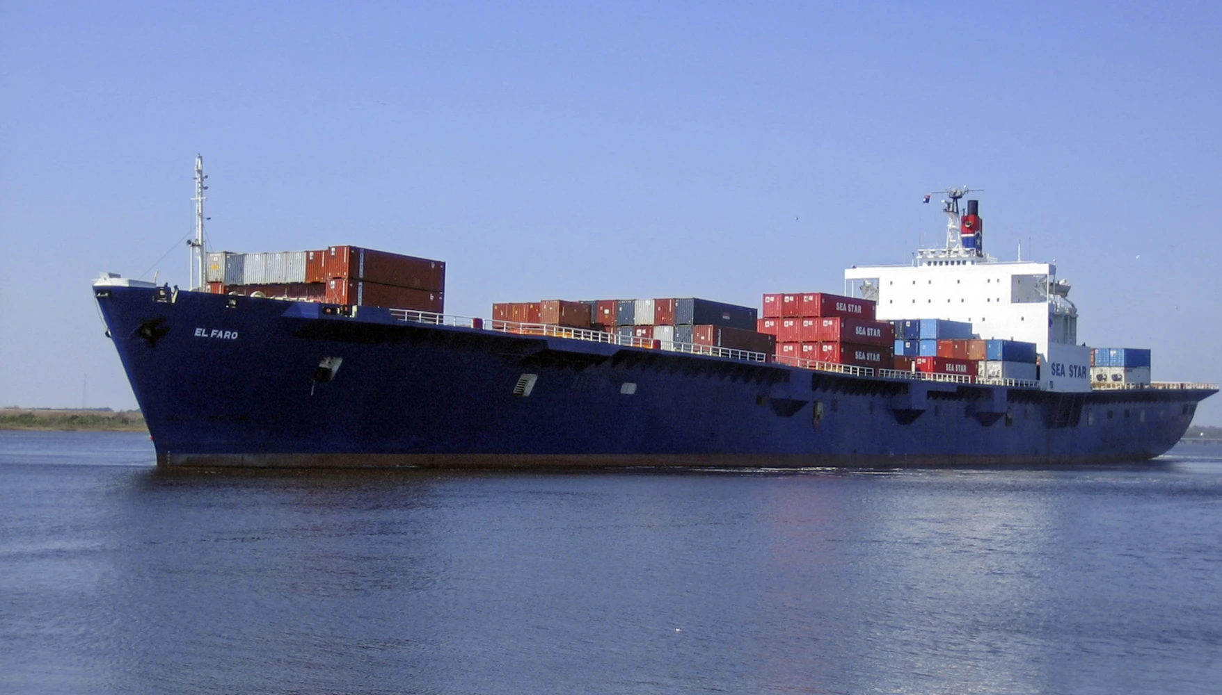
Source: Tote Maritime via EPA (NBC News)
Click Button for Slide Out Image
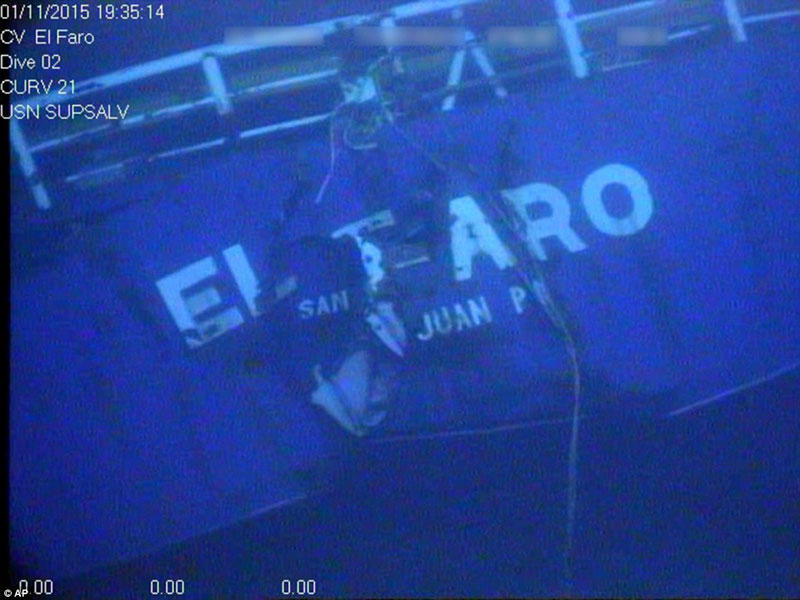
El Faro Remains - Dive photo 2015
The specific application I’m most familiar with is in the maritime community where pleasure and commercial vessels typically use climatological charts, called pilot charts, in the decision-making process. In the advent of triple La Ninas, climatological data is most likely the weather conditions mariners will not see. The notion that forecast uncertainty plays no part in risk assessment is nearsighted. It’s not the forecast itself that matters, but the potential for higher, unexpected conditions. If that potential exceeds operational limits and it is disregarded, then the mariner is in for trouble.
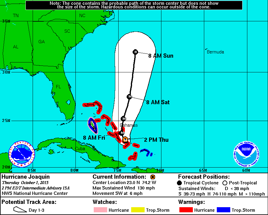
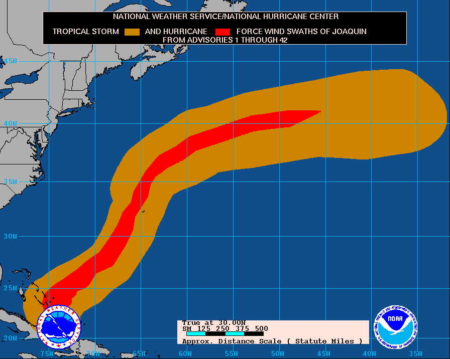
Case in point is one of the worst maritime disasters in U.S. history, the SS El Faro sinking with all 33 lives aboard lost. The El Faro was a 790-foot commercial cargo ship that departed Jacksonville, FL on September 29, 2015 bound for San Juan, Puerto Rico. The fully loaded ship routinely made this passage. On this occasion, however, Hurricane Joaquin got in the way. Hurricane Joaquin was a Category 3 hurricane that had undergone rapid intensification before it came within close proximity to El Faro. The National Transportation Safety Board (NTSB) found the probable cause of the El Faro tragedy was the captain’s insufficient action to avoid Hurricane Joaquin, his failure to use the most current weather information, and his late decision to muster the crew1. The day before the sinking, the captain charted a course to pass the storm’s eye at a distance of about 65 nm. In this expert’s opinion, 65 nm is too close to pass the center of a hurricane. The 24 hr and 48 hr 5-year mean track errors are 45.0 and 77.1 nm2. From this fact, it is apparent the captain had little knowledge of the unpredictability and track errors associated with hurricanes.
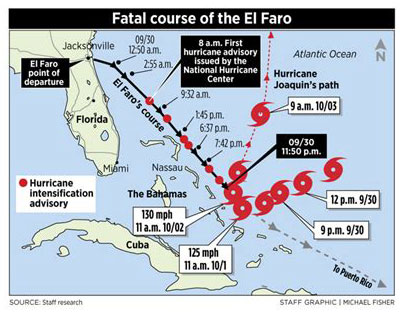
Source: Central Maine, Michael Fisher
Click Buttons for Slide Out Images
NWS Probable Path of Hurricane Joaquin
Those professional meteorologists that are certified by the American Meteorological Society have the technical knowledge and years’ worth of expertise and training to make sound, unbiased judgements based on the interpretation and synthesis of multiple sources of weather data, not just a single chart or model product that may or may not be applicable in a given situation. These professionals have the designation CCM (Certified Consulting Meteorologist). CCM’s can make clear and concise recommendations to operate or not operate based on reliable forecasts and operational weather parameters.